Family trip to Joshua Tree!
The Meaneys (minus Jack) took a trip to Joshua Tree. It was amazing.
Patrick and I headed out on the evening of Thursday, 4/8/10, and spent the night at the BLM dry lake bed, that is now covered in little green sprigs of growth! It used to just be white, dry mud.
Here's Patrick with the
new tent we bought with our REI dividend:

Thomas tries it out as well:

Monday we were rudely awoken at 6:30am by the stupid model airplane guys, who apparently fly their pathetic little model planes every day of the week, including Friday. They must not have jobs, but then they probably save a lot of money by living in their mothers' basements and eating nothing but cold Spaghettio's three meals a day and never dating. We were a little grumpy about it. Mostly because we hadn't gotten the tent pitched and into the sack until about 1:30am. Oh well.
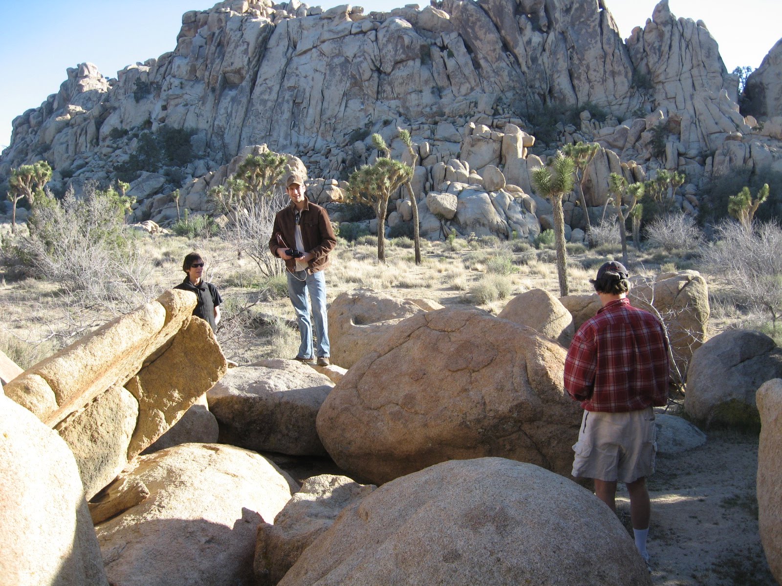
We had an awesome breakfast at Crossroads and then headed out to Indian Cove to get on some rock.
We were going to "warm up" by trad leading this "5.5", but it turned out to get a little tricky right at the top of the route, and there was nowhere to put in pro. So the leader (Thomas) bravely decided to heroically turn around and fearlessly climb back down the way he came.
Instead we walked up the backside and just set up a top rope, which was more fun:

Next we sport led this 5.8. Forget the name of the crag, but the route was called White Trash. It was a little scary...not actually dangerous or anything, but just a very rigorous climb, made harder by the heat and the fear factor. Very satisfying, though.

After White Trash we broke for lunch and got a voicemail that Mom and Dad had left at noon. Being that it was around 3pm we figured they should be getting in right about then so we headed over to the hotel just in time to find them checking in!

After checking in we drove in the park and did a little walking about:

Patrick and Mom in the area in front of Hemingway Wall:

Patrick and Thomas and Thomas's yachting shorts:

Mom with one of the gorgeous "claret cup" cacti:

Leezard in repose:

Hemingway wall in the background:

Dad spots a bunny en route to Barker Dam (can you find the bunny?):

Super-high water levels in Barker Dam! Record high, almost. 12' deep in front of the dam:

Patricio:

Dad in front of the dam:

View from the dam. So much greener in this area because of the flow from the dam:

Yet another dam picture:

Mom and Patrick next to what could be either a watering trough for cattle, or an old sluice box from the gold mining days. Either way it was very old, and had these great, hand-forged squarish nails holding it together:

A Joshua tree:

Patrick near Skull Rock:

Hiking up to the top of Ryan Mountain. We meant for this to be just sort of a stroll, but the hike turned out to be pretty tough. Molto steep!

View of the high desert floor from the trail up Ryan Mountain. Look closely and you can see loads of Joshua trees:

The summit!

Where was this again?

Patrick on Ryan Mountain:

Patrick reclines in a naturally ergonomic rock:

View of the Coachella Valley, etc.:

An awesome tree in Real Hidden Valley:

Family with said tree:

On Sunday we took a hike to the 49 Palms Oasis. It was another tough hike, but worth it. I'd never seen an actual oasis. Sadly you couldn't really get too close to the water 'cause it was a protected natural area (or something...I stopped paying attention).

A shot from right next to the oasis:

Momma looking fresh and utterly unphased by the hiking:

A respite beneath the huge palms:

The hike back from the oasis and everyone is having FUN!

Highlight of the hike! We found a desert tortoise plodding along:

View from the ridge with 29 Palms in the background:

Pulled over on the way back to take a snap of San Jacinto. We'll have to come hike it sometime soon.